| M.o.S.
Brasside Ammo Dump, Chester-le-Street Model Flying Club and the former
Plawsworth Station - August 2nd
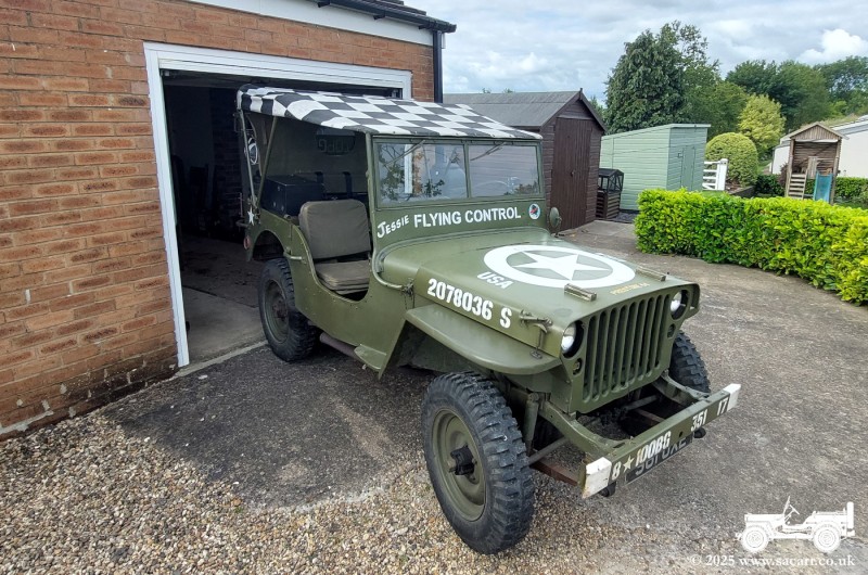
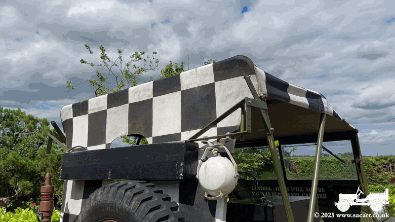
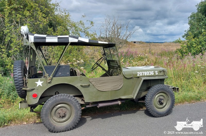
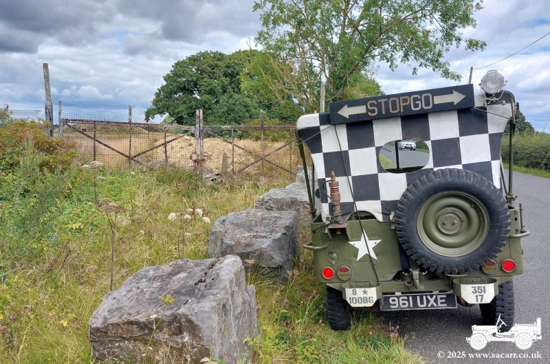
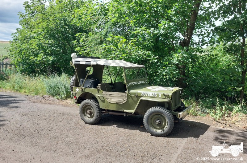
Since I don't have any events until the end of the month, I decided to have a run out in Jessie. This outing was the first try of the new, hinging light box on the back of the Jeep. The first image is the Jeep squeezing out under the garage door, while the second is an animated gif, showing the quick assembly now. Hinge up and two screws to fit. For a while, I've wanted to visit
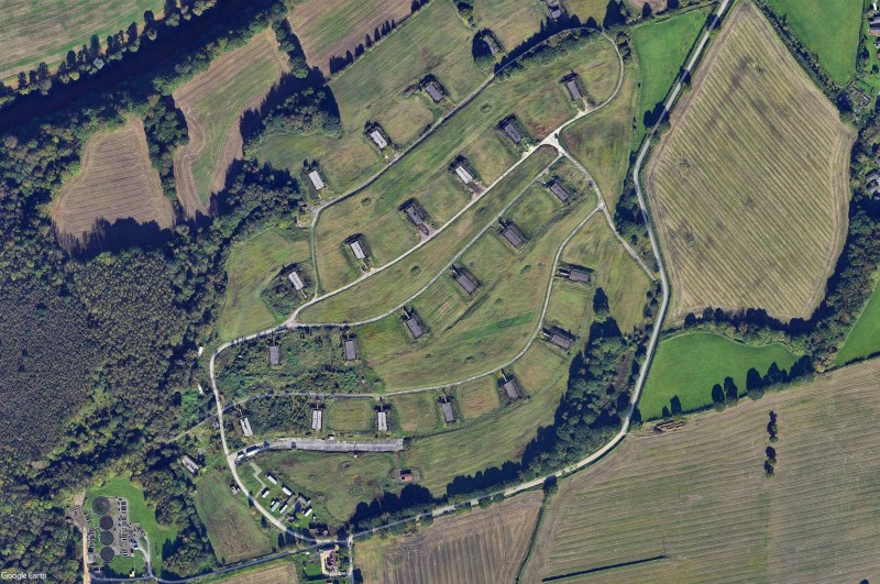
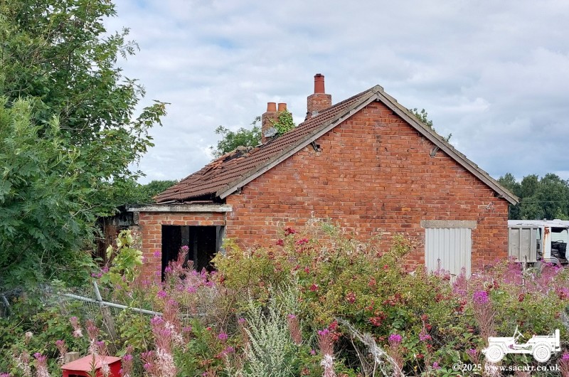
the former Ministry of Supply site at Brasside, Durham. M.o.S. Brasside
was an ammunition dump. A small road skirts the Southern and Eastern
edges of the site, while a railway brought munitions in through the
South West side, splitting into four sidings within the ammo store. I
arrived at the former main gate to the site, parking by the gate with
the old guard house behind. |
|||
|
|
|
|
|
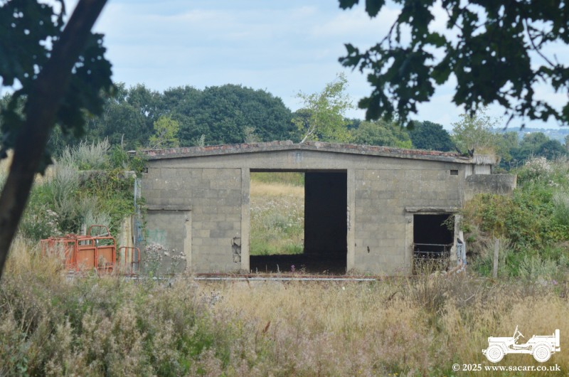
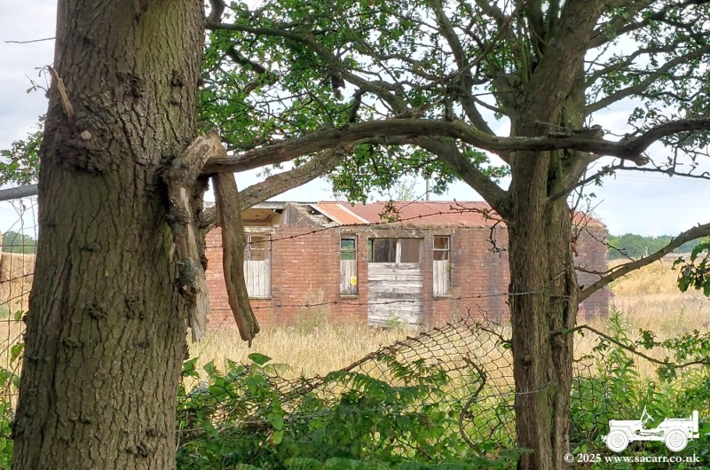
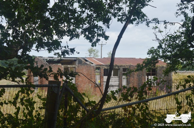
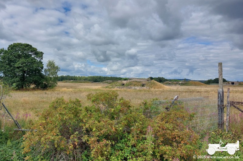
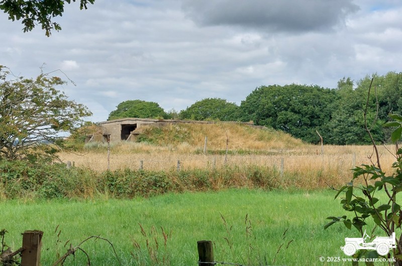
There are many buildings and the bunkers which survive on the site, although the brick built buildings are suffering more than the concrete ones. The site is all private property, so all my pictures were taken from the road that runs around the edge of the site. |
|||
|
|
|
|
|
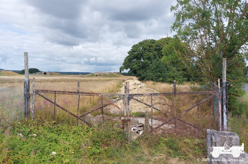
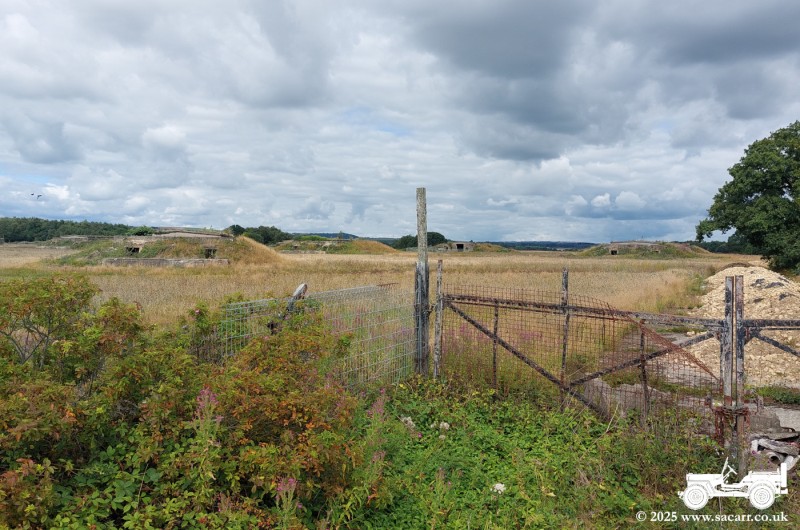
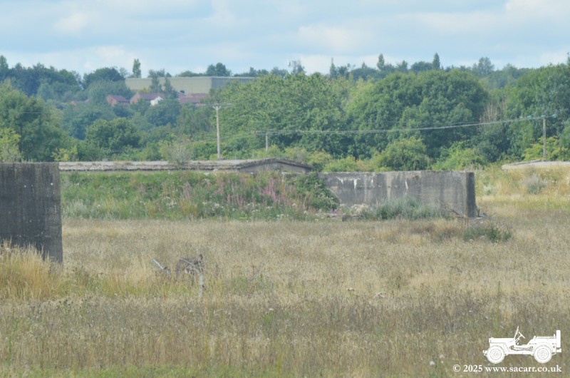
I carried on following the road and stopped on the East site, next to another entrance to the site. Several concrete blocks stop access, 'though the road is covered in piles of gravel and impassible anyway. A number of bunkers can be seen from this location. A search on Youtube will show videos of the inside of the site, from a number of urban explorers. |
|||
|

|
|
|
|
While the mesh on the gate had been ripped off allowing on foot access, I'm not one to tresspass, so kept my exploring to through the camera lens from outside the perimeter. |
|||
|
|
|
|
|
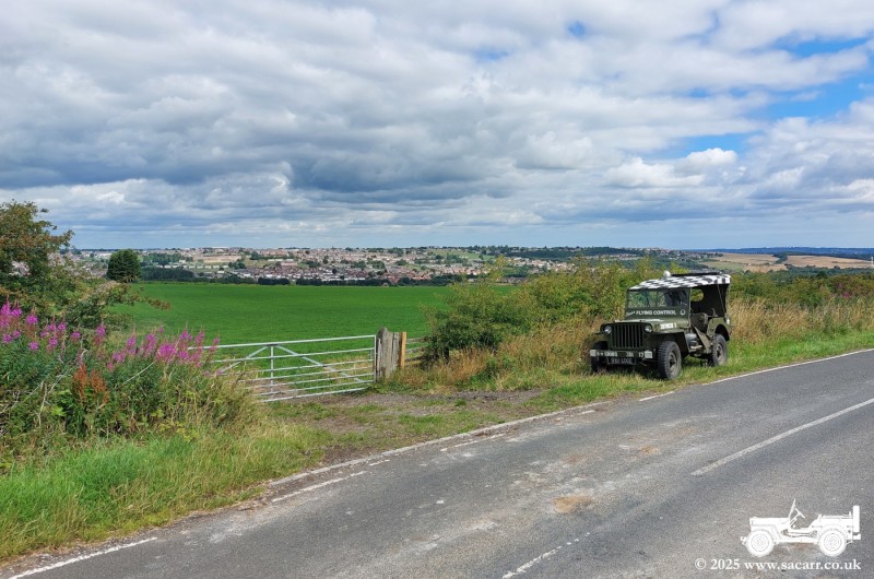
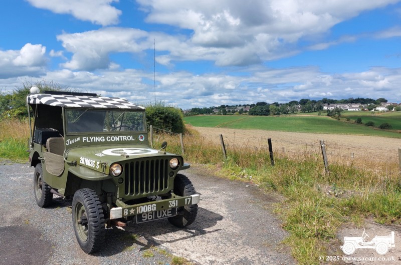
I left Brasside heading West North West, gradually gaining height to the Chester-le-Street Radio Model Club flying site near Craghead. The site is around 800 feet above sea level on farmland that was usually occupied by sheep. I learned to fly models here, starting in 1983 and it was usually windy and rarely warm! I recall snow in the roadside ditches in June one year.
The first picture shows my Jeep, parked on
the roadside, with the original club flying site through the gate. Picture two
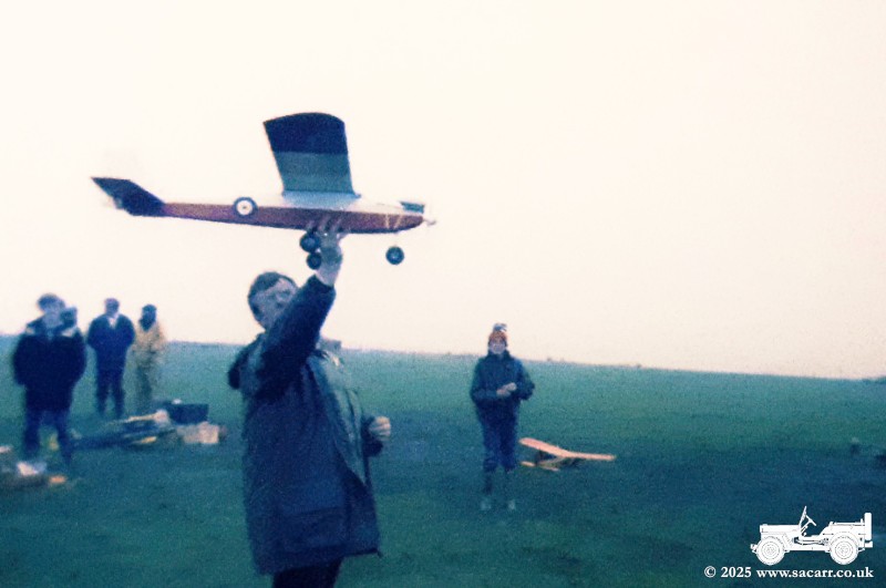
is my first trainer, about to make its maiden flight in May 1983. The
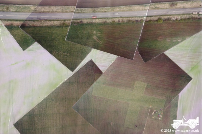
composite image is from 1988, taken from an aircraft I built for an 'A' Level
design project. It shows the two crossed runways, pits areas and the road
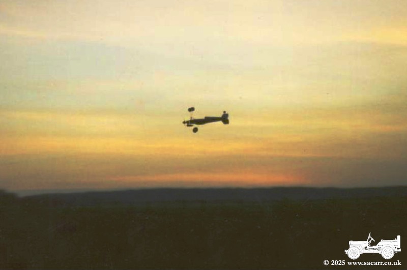
where the Jeep is parked. The sunset picture was from 1989, with this flight
being the last from this field. Shortly after I landed, the farmer ploughed up
the field. |
|||
|
|
|
|
|
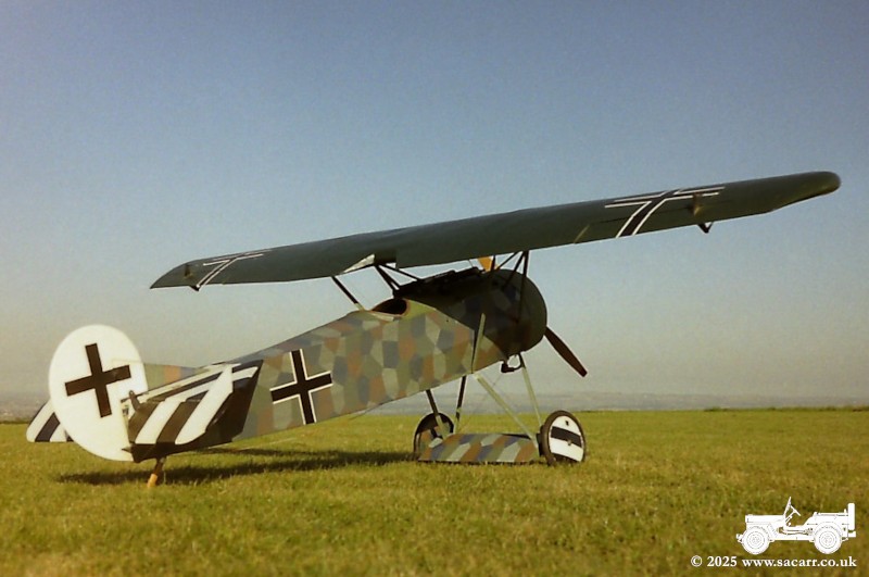
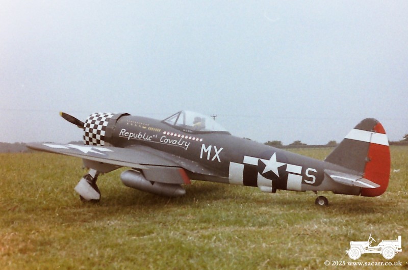
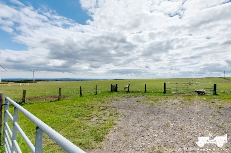
After a brief try of another site about a mile away, the club returned to the farm and set up in the field immadiately over the raod from the old site. The first picture below shows the two runways again, with three pits areas. That's me standing on the edge of the runway, with the picture taken from one of my models. Next is my 1/4 scale Fokker EV, followed by my 1/6 scale, scratch built P-47D Thunderbolt. The last picture was taken today of the new site, looking towards the runway, which now just consists of a large rectangle of mown grass. Since I last flew there, the club has fenced off a small car park area in the corner of the field. |
|||

|
|
|
|
|
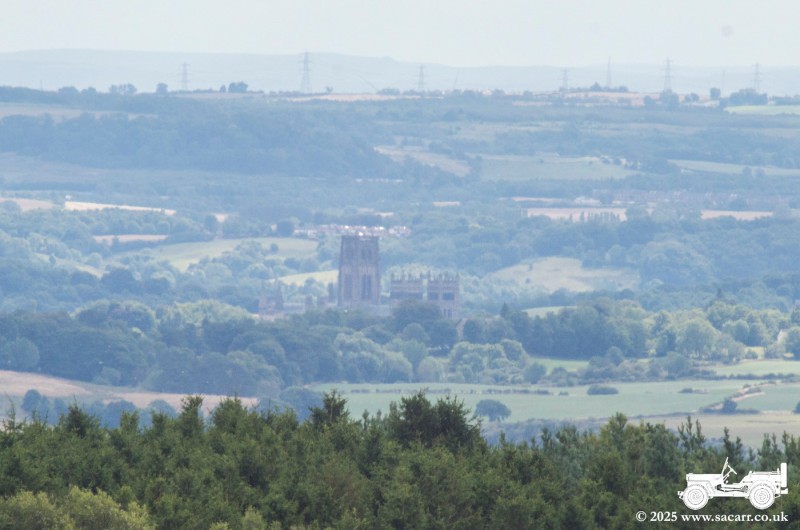
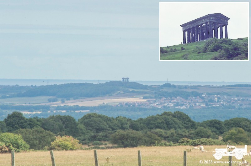
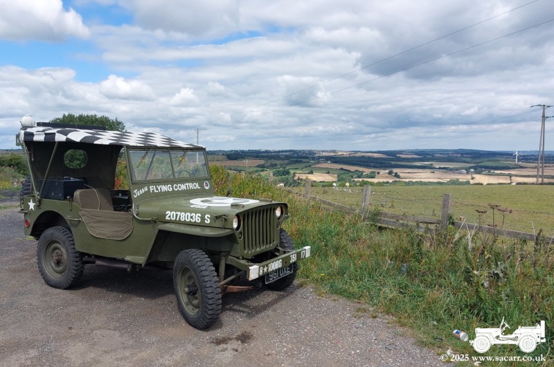
Despite it being a nice day, nobody was flying today. I waited around for half an hour, but nobody showed up, so I set off again, heading to Burnhope. Both the wind turbines at the flying site and Burnhope radio mast, can be seen from our house in Durham. After passing through Burnhope, I doubled back on a road a little South of the flying field. From there, I could see Durham Cathedral, Penshaw Monument ( Greek Temple replica ) and some generally great views across toWashington, Gateshead and South to the Cleveland hills around 35 miles away. |
|||
|
|
|
|
|
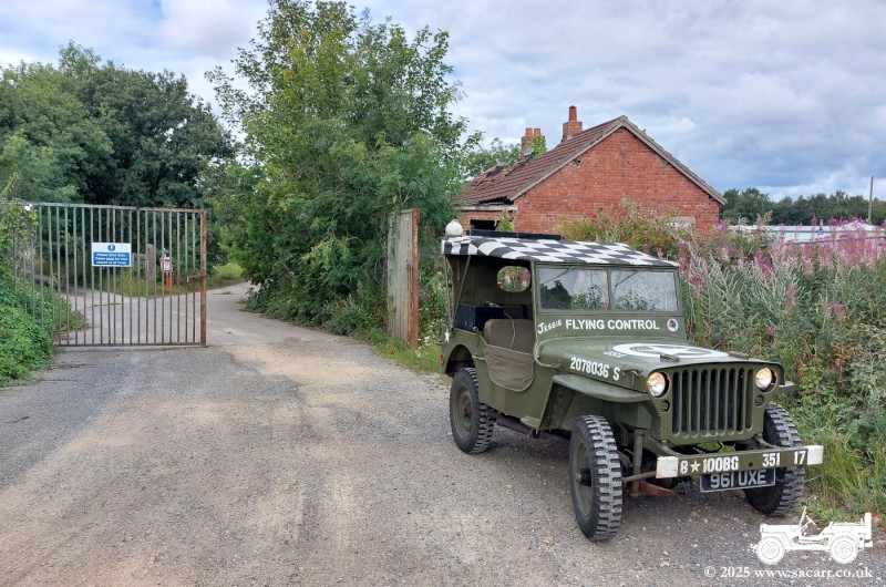
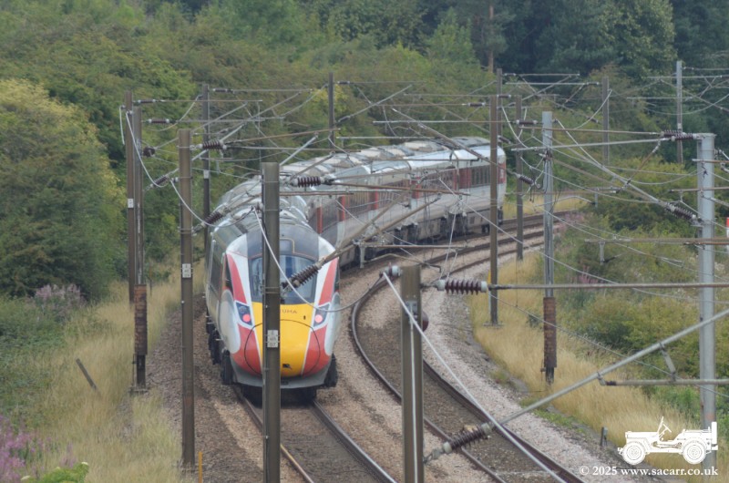
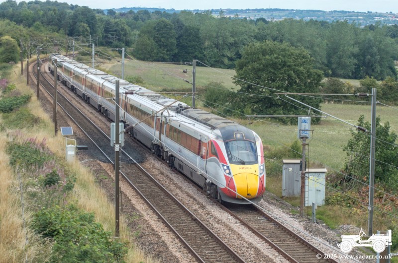
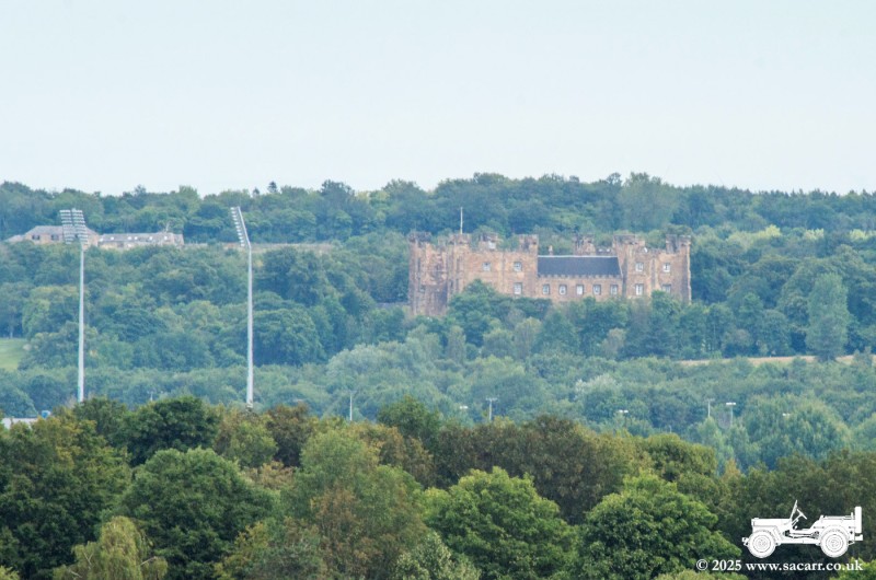
I travelled home on more or less the same route that I had taken, parking on the entrance road to the former Plawsworth railway station. Close by, there was a road bridge over the East coast main line, where I stayed a few minutes to photograph a couple of LNER Class 801 Azuma, high speed passenger trains. From that location, I could see the spotlights of the Durham County Cricket Ground, with Lumley Castle in the background. I got back home with about an inch of fuel left in the bottom of the tank. It wasn't too much of a close call, as I had a two and a half gallon Jerrycan in the back of the Jeep. It had been an enjoyable 36 mile, three hour trip around the hills and lanes of County Durham. |
|||
|
|
|
|